
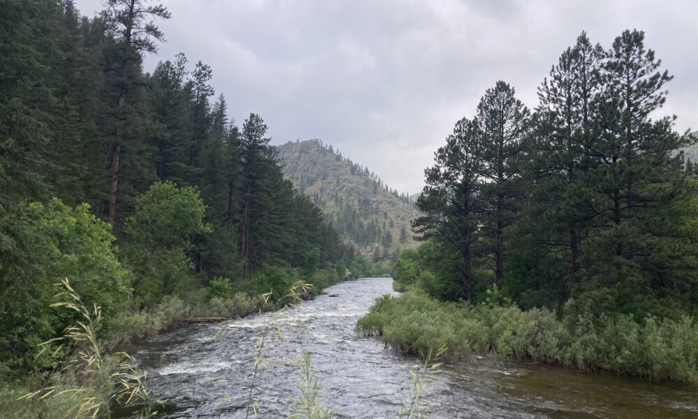

For decades, river management in Quebec has focused almost exclusively on water. However, rivers do not just carry water; they also transport sediments, and ignoring this may explain why current river management practices fall short.
At last week’s GeoSpectives seminar—an annual seminar series hosted by McGill’s Department of Geography—Concordia University professor Pascale Biron addressed this issue in her talk Integrating hydrogeomorphology into river restoration practices: A winning approach.
In drainage basins—an area of land that drains various water sources to one location—sediments are carried downstream, originating from many sources, including glacial deposits, landslides, hills, and riverbanks.
Lane’s balance model, introduced in the 1950s by Emory W. Lane, helps explain the relationship between water and sediments. It posits that a river maintains equilibrium by delicately adjusting its slope, depth, width, and flow to match the sediment load it receives.
Herein lies the problem: “The way that rivers have been managed in Quebec […] in the last decades was mainly to focus on water,” Biron said in her talk. “If [we] just intervene having water in mind, [we] may create some disequilibrium.”
Such disequilibrium arises from various human interventions, including the development of dams, bank stabilization, and ripraps, a layer of stones added to prevent soil erosion. These prevent rivers from flowing as they naturally would. A common example occurs in agricultural drainage basins, where human intervention has straightened previously meandering rivers. When this happens, the river slope becomes steeper. The river will then tend to naturally increase its sinuosity—a measure of how much a stream bends—by rebuilding meanders through lateral migration.
“There is a spiral flow […] that [erodes] the sediments on the outer bend and brings these sediments into the inside bend,” Biron said.
Flooding is a second natural dynamic informed by river hydrogeomorphology.
“In general, it is a problem where [there are] urban or agricultural developments limiting the space available for rivers,” Biron said.
The two aforementioned hydrogeomorphological movements—meander lateral movement and flooding space—are at the heart of the concept of ‘freedom space.’ This approach to river management allows rivers to follow their natural movements, including erosion, flooding, and meander migration. Riparian wetlands—which harbour biodiversity, stabilize river flows and buffer against floods—also form within this space, but cannot develop if banks are stabilized via human intervention.
Researchers have created a matrix that combines mobility zones, flood zones, and riparian wetlands to determine how much space rivers need to ensure public safety and functional ecological services. The resulting freedom spaces vary widely in width, from a few metres to several hundred.
Other researchers have also conducted a cost-benefit analysis on three rivers in Quebec—the Yamaska River, the Matane River, and the Rock River—to determine whether preserving these buffer zones was economically viable. In their analysis, the team emphasized passive restoration and easements, where landowners agree not to build or reinforce banks.
“We looked at the cost of […] the loss of right to construct in the future, the loss of right to farm in agricultural areas and river management restoration,” Biron said.
The benefits of freedom space preservation included reduced flood damage, reduced bank-stabilization costs, and riparian wetland-induced ecosystem services, ultimately outweighing potential costs across the three rivers.
Biron also advocated for effective communication of river hydrogeomorphology concepts within science education.
“No one is taught about river dynamics in elementary school, in high school and CEGEP, and quite rarely even in university, so it is normal that people are very surprised when they see a river eroding its bank,” she said.
Biron concluded by presenting her PhD student Jean-Philippe Marchand’s project One meander at a time, which helped restore a straightened river on Parentall Farm in Montérégie, Quebec in collaboration with the farmers, whom the Ministry of Environment financially compensated.
After creating the freedom space, the morphological quality of the river increased. Moreover, when Hurricane Debby hit in 2024, neighbouring farms experienced costly damage. However, the Parentall Farm did not, as flooding occurred safely within the designated freedom space, demonstrating the system’s resilience.
The freedom space concept is now being integrated into river-management frameworks, including Quebec’s Plan de protection du territoire face aux inondations. By aligning management practices with natural river dynamics, these policies aim to create more resilient and sustainable landscapes for future generations.