


Spring has felt unusually out of sync this year, with winter lingering well into late March and only brief, inconsistent stretches of warmth. Is this just a strange season or a symptom of climate change? In an interview with The Tribune, Robert Fajber, Assistant Professor in McGill’s Department of Atmospheric and Oceanic Sciences, shared his thoughts on the city’s recent weather patterns.
“Montreal kind of follows […] the same overall climate and weather patterns that we see for most of the mid latitudes,” Fajber said.
As a result of climate change, Montreal has warmed up by 1 to 1.2 degrees Celsius over the last 50 years. With this warming comes a shift in precipitation.
“Globally, precipitation changes by about two per cent per degree of global warming,” Fajber said. “However, local extreme precipitation changes more like seven per cent per degree. So if you have an extreme rainfall event, and the local warming is two or three degrees, expect that extreme rainfall event to be more like 20 per cent stronger.”
According to climate data comparing recent decades to the mid-20th century, winters in Montreal are becoming shorter and milder. Between 1950 and 1980, the city experienced about 148 frost days—the number of days when the minimum air temperature is below zero—per year, but today that number has dropped to around 130.
Winter is also shifting in time: It now starts later, moving from around Oct. 10 to Oct. 18, and ends earlier, with the last frost day arriving closer to April 20 instead of April 29. These trends are based on 30-year climate normals, which smooth out year-to-year variability, but individual winters can still differ widely, as seen this year.
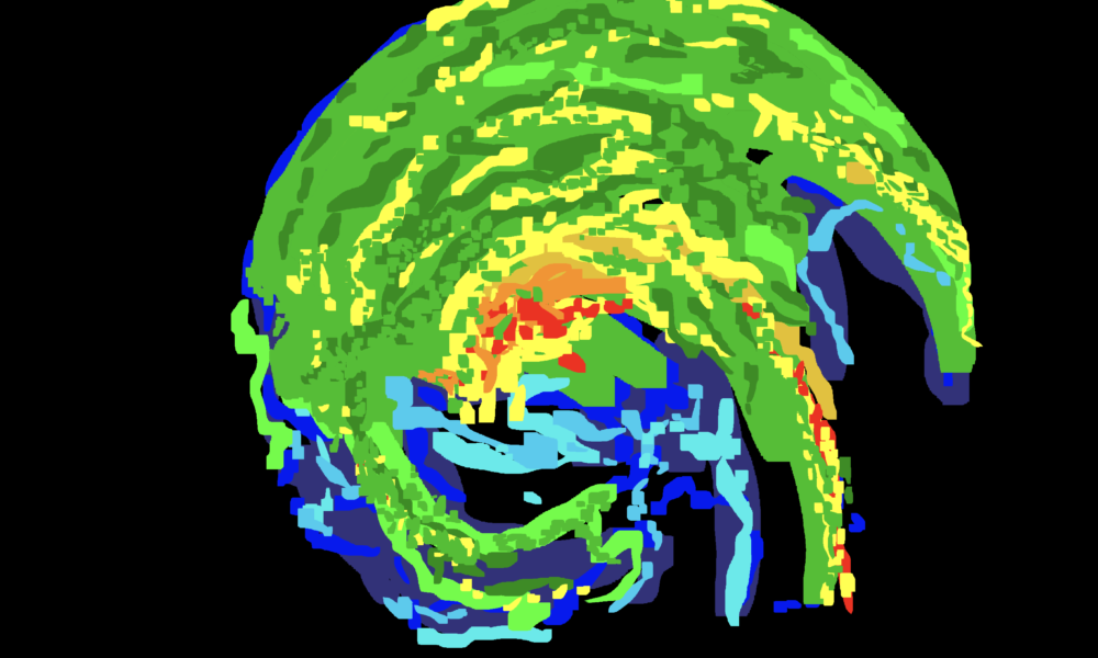
To explain this year’s odd spring temperatures, we need to understand what drives the North American climate. Much of North America’s climate is shaped by an “east–west dipole,” where one side of the continent experiences cold conditions while the other is warmer. This pattern is driven by atmospheric waves, influenced by temperatures in the Pacific and Atlantic Oceans.
Depending on how these waves shift, Arctic air can be pulled further south, bringing colder conditions to regions like eastern Canada. This year, unusually strong flows of cold Arctic air occurred, cooling Montreal.
Predicting these patterns is becoming more challenging. Over the past decade, both oceans have experienced unprecedented heat waves, starting with the Pacific “blob” around 2014, and more recently, extreme warming in the Atlantic since 2023. These ocean influences are now interacting in complex ways, making climate patterns harder to predict.
“Most climate models actually show the Atlantic as being one of the slowest places that [has] warmed on the planet,” Fajber said. “The North Atlantic warms very slowly because this is an area where the ocean actually draws down a lot of water, and as that water basically goes away from the surface. It takes heat with it.”
Looking ahead, scientists expect Montreal to see climate trends that largely mirror the past half-century. Winters will likely continue to shrink, snow cover will decline, and extreme weather events will intensify.
However, new uncertainties are emerging. In addition to the unexpected warming of the Atlantic Ocean, sea level rise remains unknown. While sudden and large-scale ice loss is considered unlikely in the next 50 years, it could significantly raise water levels in the st. Lawrence River, impacting people living on its shores.
Beyond gradual warming, extremes are the real story. Heavy precipitation and severe storms are intensifying faster than average conditions and will likely have the greatest impact on daily life.
As these changes accelerate in Montreal, adaptation strategies must go beyond individual action. While personal efforts can help, they are often limited in scope.
“We are much better when we work together on adaptations than when we try to work by ourselves,” Fajber said.